
Millbrae Neighbors: Block Sources
Millbrae neighbors are not represented by one public list. The block around an address is pieced together from records that describe land, assessed ownership, public projects, limited election data, older household listings, and civic contacts. Each source has a different key and a different meaning. GIS begins with a parcel; the assessor ties that parcel to an assessed owner and mailing destination; recorded maps show how lots fit together; permits show an application or project. Those facts can help locate the right record without turning a map result into a claim about every person at an address.
| Source | What It Shows About a Block | Access |
|---|---|---|
| GIS parcels | Geometry, APNs, situs, and selected layer attributes | Free map browse |
| Assessor records | Assessed ownership, mailing destination, and values where public | Public portal or counter |
| Recorded maps | Lot, block, and subdivision pattern | Free download or counter |
| Permits and planning | Address-based projects and applicants | City portal or request |
| Voter file | Limited registration fields | Approved statutory purpose only |
| Reverse directory | Named subscriber or householder at an address and year | Library or archive; holdings gap |
| Civic groups | Public officers and contact details, not private membership | Organization or city public pages |
For a Millbrae block, the most direct public clue is usually the parcel and its situs address, not a household roster. An assessed owner can live elsewhere, and a tax-mailing address is a correspondence destination. A recorded map can show a lot line, while a permit may show an applicant, owner, contractor, scope, and date. A reverse directory can name a subscriber or householder for an address and year when a library or archive holds the volume, but the exact Millbrae run remains unverified. Public civic contacts can point to events or officers. They do not reveal private membership. The table is therefore a source map, not a promise that one search exposes the block.
Note: A block worksheet should label each result as parcel, owner, project, voter field, historical household, or civic contact.
Millbrae APNs Start the Block Trail
An APN gives the block trail a stable starting key. Begin with the situs address, the physical location of the parcel, and capture the nine-digit APN plus any assessor or recorded-map reference. The county's Secured Property Tax Search accepts a street address or APN, not a public owner-name mode. The Assessor Maps instructions make the distinction clear: property identifiers connect to geometry, book and page references, and subdivision or parcel-map records. In San Mateo County, that address-to-APN move helps keep nearby parcels from being confused with similar street names or postal labels.
Planning GIS uses the same nine digits without dashes or spaces. For incorporated Millbrae, county parcel layers remain useful, while city zoning is authoritative. The APN is a county tax and map key, not a resident ID. Save it beside the situs address, legal description, and map reference, then use the current assessed owner only as a starting point for a recorded-document search. That sequence supports a careful neighbor lookup without claiming the taxpayer is the occupant.
Millbrae GIS Map Tips for Parcels
Once the APN is in hand, the County Planning and Building Map Viewer supplies the adjacent-parcel walk. The official zoning lookup instructions say to open the viewer, expand LAND USE, check Unincorporated SMC Zoning when relevant, and choose Find parcels by APN. Enter the digits without dashes or spaces. After Search, the parcel highlights blue. Click it for Map Tips, then use the upper-right page toggle to move through results for the active layers. For Millbrae, this is a focused way to inspect the lots touching or near the subject parcel.
- Get the subject parcel's nine-digit APN from the address search and write down the situs exactly.
- Open the Planning and Building Map Viewer, expand LAND USE, and run Find parcels by APN.
- Enter the digits without punctuation, run Search, and confirm the blue parcel highlight.
- Click the subject parcel for Map Tips, then page through active-layer results with the upper-right toggle.
- Repeat for each touching or nearby polygon, recording its APN, situs, and selected layer attribute.
- Use the public assessor record for owner and tax-mail fields, and mark those fields as assessed ownership rather than occupancy.
The San Mateo County GIS gateway documents layers for parcels, ZIP codes, election precincts, congressional, Assembly, Senate, and supervisor districts, assessor maps, and map rasters. The layer set can explain a block's geography, but it does not turn district membership or a parcel polygon into a list of residents. Map browsing is better than a countywide export for a small block. The county ArcGIS TAXPARCELS service reports a 2,000-record technical maximum per query, so a visible, focused segment keeps the result useful.
Millbrae Neighbors: Owners Are Not Occupants
An APN link can be strong evidence about land and still be weak evidence about people. San Mateo County assessment information can show an assessed owner, mailing destination, values, and property traits where public. It does not establish who occupies the address. A mailing address away from the parcel may suggest that notices go elsewhere, but it is not proof of occupancy, and a matching mailing address is not proof that every household member is named.
The same caution applies to permits and planning files. They may identify an applicant, owner, contractor, scope of work, and dates. A permit records a project. It does not list every occupant, visitor, or household member. Utility customer records and DMV addresses are protected. A neighbor lookup should therefore say what the record says, not add an inferred person.
For a historical question, use a verified reverse directory or census record for an address and date, then mark the result as a dated household clue. For a present question, keep the assessor record in its proper role. That distinction is the central myth check for Millbrae neighbors: ownership is not occupancy.
Note: The absence of a name from an index is a search limit, not proof that no person lived at an address.
Millbrae Block Records and Terms
Recorded maps and planning files add shape and context to a block. County map resources can show parcel geometry, book and page references, subdivision or parcel-map patterns, and related assessor map information. Recorded maps are useful when two addresses look similar or when an older legal description does not match a current street label. A legal description identifies the land independently of postal wording, so it can bridge an APN, lot and block reference, and an older map.
Millbrae project records add a different kind of clue. Address-based permits and planning requests may show an applicant, owner, contractor, scope, and work date. The City's Public Records page provides the municipal portal and CPRA request route for identifiable city records. The RecorderWorks index covers indexed instruments from 1985 to the present; it is a grantor and grantee tool, not a block roster, and online deed images are withheld for privacy reasons while public terminals show documents free.
Reading a map beside a permit helps explain how a block changed without assigning a project to every household. If the question turns into a whole named street, the Millbrae street directory keeps the address-by-address chain in one place.
Glossary. Several terms carry more weight than they seem to. Keeping their roles separate makes a Millbrae block lookup easier to audit and reduces false matches.
- APN
- A county nine-digit tax and map key. Planning GIS expects the digits without dashes or spaces.
- Situs address
- The physical location of the parcel. It is different from the owner's tax-mailing destination.
- Assessed owner
- The name tied to an assessment record. It is a deed-search starting clue, not proof of occupancy.
- Legal description
- The land description in a deed or map that can connect an older record to a present parcel.
- Map Tips
- The viewer's result pages for active layers after a parcel is selected. The page toggle moves through those results.
- Grantor and grantee
- The transferring and receiving parties in a recorded instrument. Their roles help trace a document, not create a resident roster.
These labels belong in the worksheet beside the source and date. A parcel result can be current; a reverse-directory entry is tied to a year; a deed index gives an instrument trail; a civic page gives a public role. Mixing them creates a neighbor story that the record never stated.
California Voter Data Is Not a Block Roster
California's My Voter Status is designed for one voter to check their own registration, party preference, polling place, and election information. It uses identity fields to authenticate a match. A non-match directs the person to check the entry or contact elections; it does not prove that anyone is unregistered. The tool is not a public surname browser or a street-by-street Millbrae resident list.
The state's voter registration guidance provides the official context for that limited path.
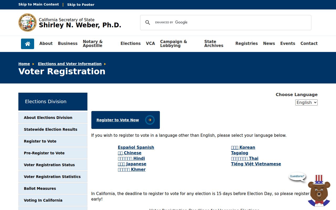
That distinction matters for a block question: a self lookup and a voter-file request are different channels. A qualified requester must identify the requester or organization, purpose, requested geography and fields, delivery, and use acknowledgments. Access depends on an approved purpose under Elections Code §2194, which includes election, scholarly, journalistic, political, or governmental use as determined by the Secretary of State or elections official.
The confidentiality rule appears in Government Code §7924.000, the source for the voter-information boundary used in a Millbrae neighbor lookup.
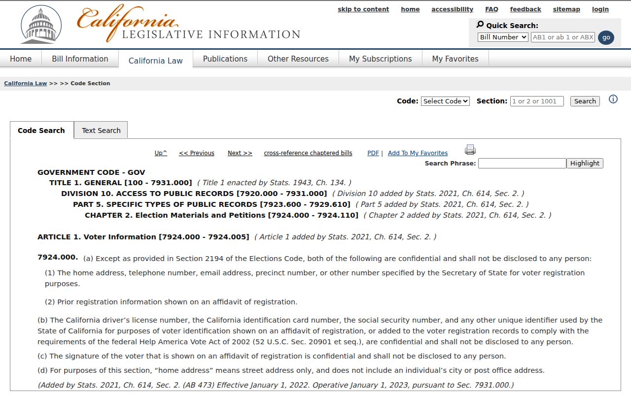
That law-focused reference keeps a block worksheet from copying protected fields. Residence street, phone, email, prior-registration data, driver-license or ID number, SSN, unique voter identifier, and signature are confidential except for narrow authorized use. Ballot selections are secret, and participation history never reveals choices. Commercial use is prohibited and may be a misdemeanor. My Voter Status remains a personal check, not a public roster.
Note: A voter-file result must retain its approved purpose and may not become a public block roster.
Public Millbrae Contacts and Private Lists
Public civic contact is a different layer from a membership list. Millbrae's city resources and Community Links search offers A-Z, Category, and Name modes and shows ten results per page. It lists organizations and agencies, with public contacts and events, rather than a roster of nearby households. City Council, commissions, schools, library groups, the Chamber, and historical or community organizations may publish a contact path or event. That can help a person find a lawful point of civic connection without naming private members.
| Public source | May show | Does not establish |
|---|---|---|
| City Community Links | Organization or agency name, public contact, event | A resident roster or block membership |
| City Council and commissions | Appointed or public civic roles and term dates | A private household connection |
| Schools, library, Chamber, and history groups | Public contact or event information | A member list for a block |
| HOA or private association records | Any contact path the association publishes | A public city directory of members |
No official umbrella neighborhood-association member directory was verified for Millbrae. HOA membership remains a private association record, and the research did not verify an authoritative city inventory of neighborhood-association directories. A public organization page should therefore be cited for the contact or event it publishes, not used to infer a household.
Millbrae Neighborhood Labels Are Geographic
Names from the City's street-tree program give a useful vocabulary for geographic orientation. They do not prove a formal association, a boundary, or a person's identity. The labels can help group a block question, but each parcel still needs its own APN, map, or record source.
- Airport Park, Capuchino, and Glenview Highlands
- Green Hills, Lomita Hills, and Marina Vista
- Meadow Glen, Millbrae Meadows, and Millwood
- Bayside Manor, Millbrae Estates, and Millbrae Highlands
- Millbrae Manor, Millbrae Park, and Millbrae Villa
Airport Park, Capuchino, Glenview Highlands, Green Hills, Lomita Hills, Marina Vista, Meadow Glen, Millbrae Meadows, Millwood, Bayside Manor, Millbrae Estates, Millbrae Highlands, Millbrae Manor, Millbrae Park, and Millbrae Villa are program areas or neighborhood labels in that source. A label should stay in the geographic column of a worksheet. It should not be rewritten as association membership, a census fact, or a claim about who lives nearby.
Official Rolls Versus Commercial Neighbor Tools
Two kinds of lookup can appear to answer the same question, but they produce different evidence. Official county and city sources are tied to a custodian, a record type, and an access rule. A commercial neighbor-lookup service may combine public fragments and other licensed or brokered data into a convenience result. Convenience does not make the result complete, current, or proof of identity. Compare the category before relying on a lead.
| Question | Official county or city records | Commercial category |
|---|---|---|
| Starting key | Address, APN, recorded name, project, or approved voter request | Name and address combinations or compiled data |
| Authority | Custodian record with a defined source and scope | Private compilation with a source trail that may vary |
| Useful clue | Parcel geometry, assessed owner, map, project, or public civic role | Possible contact or identity lead needing confirmation |
| Access | Portal, counter, request, or approved statutory purpose | Service terms, account, paywall, or privacy choices may apply |
| Privacy boundary | Protected voter, DMV, and utility fields remain restricted; HOA membership stays private | Not permission to expose or republish personal details |
For Millbrae neighbors, official rolls work best as narrow records: a parcel, map, project, permitted public field, or civic contact. A commercial category result is a lead that needs verification with the relevant custodian, and it cannot turn an assessed owner into an occupant. Avoid pasting either result into a public block list.
Millbrae Neighbor Lookup Privacy
Some people are absent from public-facing records by design. California Safe at Home serves qualifying survivors of domestic violence, stalking, sexual assault, trafficking, child abduction, and other defined participants. It supplies a substitute address, while confidential voter registration and DMV or name-change protections have separate steps. A missing address is not an invitation to fill the gap from another source.
The Safe at Home program is the official reference for that substitute-address and confidential-registration context.
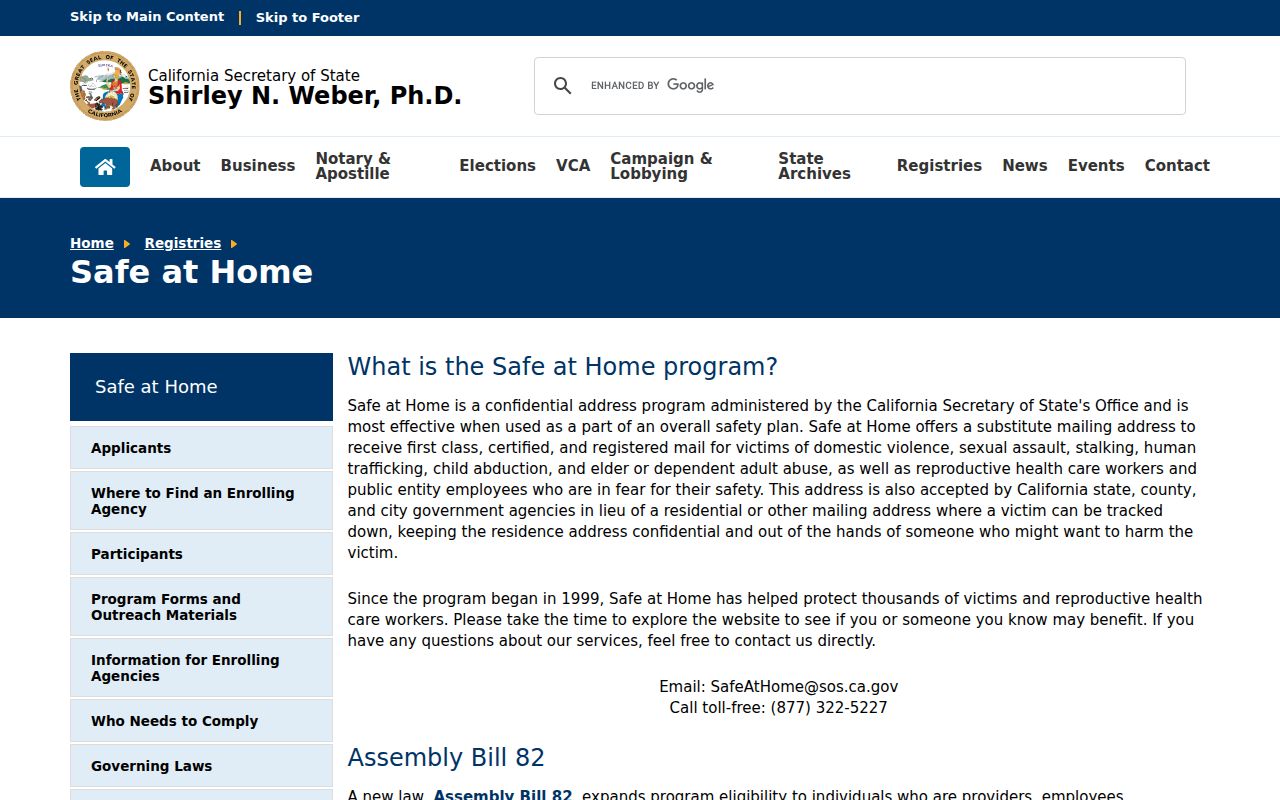
The image belongs beside the privacy note, not in a block worksheet: protected status should not be inferred from a missing parcel name, mailing address, or voter result.
California's DROP platform launched January 1, 2026, and registered data brokers began mandatory processing on August 1, 2026. One request can be sent to registered brokers, but public-government records are corrected with the custodian, not erased merely because they are inconvenient. DROP deletion applies to brokers, not official assessment, deed, map, permit, or voter rolls.
The California Megan's Law website is a separate registry reference and should be treated as context, not a neighbor directory.
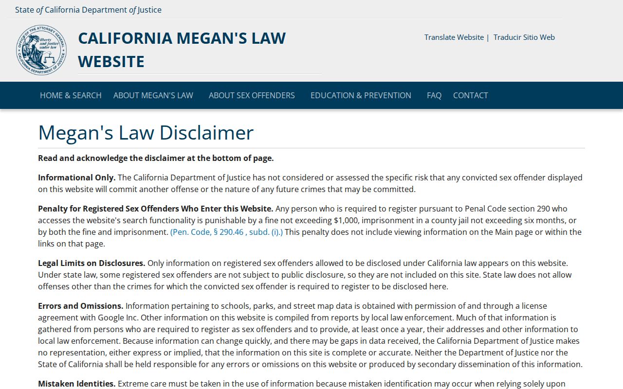
Its search modes and warnings do not prove that a registry result identifies a resident of a given block. Do not expose personal details or imply registry status proves neighborhood identity.
Lawful use. A Millbrae neighbor lookup is appropriate for personal record research, reconnecting, civic contact, property history, and safety awareness. It is not permission to watch, threaten, harass, intimidate, or publish a private block roster. Stop when the record is protected or the purpose is not lawful.